Thursday, July 16, 2015

The Back Roads from Sea View, Part 3

Another Saturday trip from Seaview was out the length of Summer Street. We are now going to Scituate to shop.

If you recall in my last blog, we got to Prospect Street. and through the Hills.


That's Summer Street in the center & left side,  the "S" curve. The East Marshfield Railroad Station is on the left, at the tree line. The old wood street sign is just showing on the left foreground
So around the ''S'' curve at the bottom of Prospect Street and up the long hill. On the right was a marsh fed by the Hannah Eames brook and high tide water. This became become Murdocks Pond in 1958. It had nothing to do with supplying water for the trains. A huge colonial home stands looking over the now pond.

As we climb the hill, houses are stacked side by each on the west side, while the east side is bordered by a long, well-built stone wall.


Looking south from behind the stone wall towards Marshfield Hills.
The school house behind the tree.
Near the top of the hill on the right is a huge mansion with a masonry stone wall. The lawn was neatly groomed and there were many red cedar trees around the buildings. In the spring, there were flowering trees everywhere. This was known as the Lampson estate. It is now owned by a member of the Aerosmith band.


 An early photo of 922 Summer Street -- Lampson's
As we approached Stoddards Corner, on the left was an old wood sign with a hand carved finger pointing toward Boston. "To Boston" was painted on the sign, a collectors item of today. Next on the left was a half cape house in complete disrepair and falling in, a former Ewell home. At the very end of Summer Street was another mansion, with a huge barn across Summer Street.


Looking from Spring Street at Stoddard's Barn on Summer Street

These overlooked the North River. It is now the home of South Shore's Audubon.


Looking north to the North River and Wills Island, Scituate. The railroad runs in front of Wills Island to the right.
The original Main Street is in the foreground, just a few feet east of what is now Main Street.

Across Summer Street, looking south, this is now called Patrick's  Lane.
We then would merge onto Route 3A, and go down the hill to cross the North River. As we approached Little's Bridge, there was the Toll House on the right -- long gone in my time.


There was a big colonial home on the left, known as Riverside Rest, and now Mary's Boat Yard.

Looking south from Scituate.

Over the bridge on the right was a shack sitting on some fill that was flooded at most high tides. A clammer from out of town established a bait shop called Lew's to sell bait clams, lobsters and fish bought from local fishermen. Clams and lobsters were kept in the pools out in the marsh to keep them fresh.

When Lew ran out of inventory, he wandered out to a pot hole and retrieved a fresh supply. Lobsters could be bought fresh, or cooked on weekends.

Route 3A was the main route to Humarock Beach for the summer residents. Lew's provided the tourists fresh seafood for the weekend.

I was once told that Lew would bring a few buckets of fill to dump on his claim every time he arrived. Also, certain customers would receive a few clams for a bucket of fill. I have no proof of this rumor.

The present building on the site of Lew's Bait Shop.
The road, 3A, across to Greenbush was under water at most extra-high tides. I once remember my Dad driving back to Seaview through the high water. I was in fear of driving off the road into deep water!


Ray Freden, Seaview/ Marshfield, 70 years.

Wednesday, April 8, 2015

The Back Roads from Seaview, part 2

--> My Dad would sometimes take a different road on his way to shopping in Brockton on Saturday morning. My last blog took us by way of Pleasant Street. This time was up Summer Street [north].

Quite a number of years after the Railroad was discontinued through Marshfield,
Summer Street and a bridge over the tracks remained. Not until after WW2 was Summer Street straightened and the bridge removed.

Looking north from the Summer St. Bridge.
The water tank can be seen just right of the barn roof.
Next on the left was a huge barn where the White Brothers Milk Company of Quincy kept their trucks for the area's deliveries. Milk trucks were parked all around the barn. Years later it became Torrey Little's Auction Barn.

On the next corner was Josselyn's Store, stashed full of penny candy. From the store you could see the water pipe over Summer Street that once carried water from Wales Pond on Pleasant Street to the tank alongside the tracks. The water was used to fill the steam locomotives.

The water tank at the East Marshfield Railroad Station. Its name was changed to Marshfield Hills in October 1890.

As we started up Prospect Street, looking back at the Railroad Station (left).
Stackhouse Pond and Walkers nail factory (right).
 
Summer Street bears off lower left. Note the street sign in the triangle.


 As we approached the top of Prospect Hill, stately homes lined both sides of Prospect Street.


Next to the Marshfield Hills Store was a blacksmith shop.


The G.A.R. Hall and Hills Fire Station on Old Main Street, looking west.


The four corners of the Hills, looking from Highland Street to Pleasant Street with Old Main Street passing from left to right.


Prospect Street to Highland Street looks much the same as it did 70 years ago.

As we approached Main Street [Route 3A], the traffic lights changed to red. Not a car passed the duration of the red light. This was the only traffic light in the town.

We would continue down Highland Street with not much of interest to a seven year old. The next intersection was Valley and Oak Streets. This time Dad would take Oak Street. Quite a change of homes from Prospect and Highland Streets!

As we came to the intersection of Union And Oak Streets, my Dad slowed to a stop. There was a very loud noise unlike anything I had ever heard! There was a whirring-buzzing sound like a bumble bee buzzing around your head.

There were a few cars parked in the field, and people were standing in a group.
My Dad made the turn onto Union Street and as we passed slowly, I could see a post with a string and a small machine racing around in a circle.

“Dad, Dad, Whatzat?”

He replied “Racecars, I think.”

“Go back, Dad. Please go back!” I hollered.  

Mom piped up, “Bill, keep going. We'll never get home!”

Going shopping and getting home was last thing on my mind.

A little bit further, Dad slowed, turned into a driveway, and went back, then turned onto Oak Street and into the field. I was out of the car and pulling Dad. Mom was hollering about getting too close! A miniature car was screaming around the track so fast it was just a blur!

Close to us was a bench with a car sitting on top.


I edged close to it and was dumbfounded. It looked like a real race car, only about the size of my Dad’s shoe.

I knew what a real midget race car looked like -- my uncle Webster built one in his barn in Humarock.

As I was admiring the mini race car, a man said, “Have you seen these before?”

I responded, “No-sir.”

He said, “These are miniature Indy cars.”

“Huh,” to myself.

He went on, “That’s a model airplane engine. I built this one, but you can buy kits like the one racing.”

“Oh, how much are they?” I asked.

“About one hundred dollars, and then lots of extras.”

Then silence from the track, a sputter, another sputter, then people clapping.

The man said, “Over 90 miles per hour! I'm up soon, see you again.”

Then I heard, “Bill, Bill, come-on.”

Mom was not happy.


A Tether Car Race Track.


 Onto Union Street, passing The Hatch Mill and pond.

The big barn at Tracy Hatch's -- they grew flowers in big greenhouses out back.
Another pond on the left. A cart path went around a pond up to Magoun's Pond.

There was a clearing used as a picnic area. 
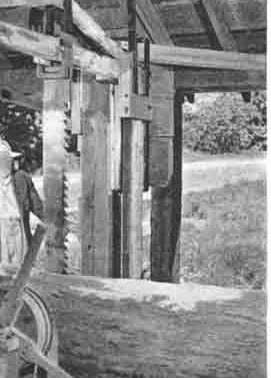
The box mill was long gone. The Magoun Brothers built a park around the pond as well as a miniature sawmill. The area was to be enjoyed by everyone interested.


 Just a short way on Union Street, Maryland Street would take us to Pembroke.

As we beared to the right, Lantz's Chicken Farm was on the left. There was a large fenced in area along Union Street and Maryland Street. It formed a large triangle with low sheds inside for the chickens to roost. As we proceeded by, stray escapees ran up and down the fence line as well as in the street.

I remember saying to my Dad , “Let’s stop and catch one.”
“Just keep going, Bill” were the last words for a while!

Maryland Street turned into Water Street in Pembroke. A beautiful home was on the right -- stone pillars on each end of the circular driveway that went through an overhang porch from the house. It too was made of stone, much like on a mansion. It had beautiful landscaping and overlooked the North River and a small island. It seemed to be used only in the summer. Another mystery to me.

Off to Brockton we went. I remained in the car, not going into Sears and Roebuck to look at bikes, no Swedish Bakery samples -- I don't remember anything except the buzz of those mini race cars.

My Dad found out more about the race cars the next day, from his friends at work. He learned that races took place at Holledge's, on weekends. A big race was on Labor Day.

After a dump trip on the weekend, I would convince Dad to take a run to
Union Street to take a look for any racing. Only once that I remember was a single car screaming around the track.

Labor Day came and you couldn't get near the place. Dad would have no part of staying. Little did I know that I would not see tether racing again for over four years.

On December 7th 1941 the Japanese bombed Pearl Harbor and we were at war -- three days before my 7th birthday. Racing was over -- most everything was over -- it was pretty quiet around Seaview for the next four years.


I have never forgotten the impression those mini race cars made on me.


A mini race car owner doing a last minute check.

“If I ever thought I would remember so much of my youth, I would have paid more attention to details.”


Ray Freden     

April, 2015

Friday, January 16, 2015

The Back Roads from Seaview

Some of the following is ''as I remember'' c.1940 to the 50s. Most are observations with too little information for a full story.

A previous blog mentions that a shopping trip was usually on a Saturday. This would be a trip to Rockland or Brockton, the closest cities. I would get piled into the old Chevy and off we would go.
Up Summer Street and left on Pleasant Street. Through the abandon Railroad bridge with great granite walls on both sides.


Next on the left, was Gino Rugani's huge Sterling trucks parked on Dog Lane.


A great sight for a young truck guy.

The Peacock Tea Room on the right was my favorite place for an ice cream.

Fields of tomatoes lined both sides of Pleasant Street.

Just before Canoe Tree Street, on the left, was Ruthven Farm.Two huge stone pillars were on each side of the driveway that led up the hill to a sheep farm. They also had a peach and apple orchard. The field was full of sheep grazing. On occasion the collies were amongst them. The collies were left to roam and to my delight they would visit my back yard for a scratch and a treat.

Left on to Canoe Tree Street. I was told that there were huge birch trees once where the pines now stand, and that the Indians made canoes from the bark of the trees. [As told to Philip Randall by an old timer from the Hills.]

A left on Route 3A [Main Street], then a right on Pine Street, with Murphy's Chicken farm on the left where St. Christine's now stands. Next on the right was the Pine Street dump, usually burning or smoldering. See my blog of  6/6 2011.

Through the Forest Street intersection and down the hill. Dad would throw it into neutral to coast,  saving on gas. Half way down Pine Street on the right was a cottage with brick pillars on both sides of the driveway. Just after the cottage was a brick yard and factory. Although in disrepair, it was steaming from the hot kiln.

A clay pit was just after the mill. It was owned by Pete, or at least that's what my Dad called him. Later in years my Dad would get clay from this pit to recondition  clay tennis courts he cared for after WW2.

As we slowed to turn onto Union Street, my Dad would point to the old saw mill across Union Street.
He would say, ''That's one of the oldest mills in the country.''

Note the pile of logs right of the shed.

Photo by Ray Freden
While I am here at the corner of Pine and Union Street, let me jump ahead a few years.

The spring of 1946, the corner of Pine and Union Street became a show place for whirligigs and lawn decorations. Franklin S. Hatch, the son of F. Decker Hatch, was making lawn decorations in his Dad's cellar and displaying them on the front lawn for sale. This was in addition to working at the Hatch mill as sawyer with his Dad and the Fish brothers.

Franklin was also a devoted trapper. He ran a trapline along the North River. Mostly for muskrat, however beaver, otter, weasel, and fox were also taken. He sold the pelts to a buyer in Hanover. Years later, Franklin had told me that during the depression that muskrat hams [the rear legs] were a common dinner at the Hatch's. 

In 1947 my Dad went to the mill to buy lumber. There I met Franklin -- he showed me how the saw worked. I was amazed by how easily the saw cut the logs. and how close Franklin was to that buzzing saw! From then on I paid a little more attention to the goings on as I passed that corner.

By 1949, I was developing a passion for woodworking. About 1952 or 3 Franklin got married and  settled in at 587 Pine Street. During the first years there, Franklin constructed a model of his Dad's sawmill, "Hatch Mill." He situated it on a small brook behind his home. He built a dam with a spillway that fed the water wheel that operated the saw. The original Hatch Saw Mill had an up and down saw as shown below. A circular saw replaced the slow outdated up and down saw. Franklin's model was fitted with a circular saw, complete with a log mounted on the carriage. Wood pinned post and beam construction was used and miniature wood shingles on the roof. A small pile of miniature logs sat nearby the mill as if to be rolled in at anytime.

This sketch reminds me of Franklin's model.


The up and down saw traveled forward 3/8'' on the downward stroke.

Although this is not the Hatch Mill, it is similar.
I think it was 1955, I went to take another look at this wonderful creation, and it was gone. I questioned Franklin as to where it went and he told me he sold it! I was not told to whom or were it went. Myron, a Pine Street resident, was shown by the current owners. The remains of pylons were the model mill had stood.  

As we traveled on Union Street, there was a big white house on the left side with a tennis court, a park with a small golf course, it looked like a fun place.I  always wondered why and who would have such a wonderful place. Not until recently have I learned who owned it and why it existed, a mystery to me for years! A very talented man by the name of Erle Parker and his wife were the owners from the mid 20s to the 60s. I have recently received the following from their  Grand Daughter Nancy.

Magoun Cemetery, off Union Street.
"Erle Parker bought the house, barn and 35 acres as a vacation home. After operating the Wayside Press greeting card business in Boston for many years, he tried to retire to Marshfield in his 40's. He began as a verse writer for Rust Craft Card Company. Due to inflation, he restarted his Wayside Press business in the barn, hiring local women to hand paint his cards. Some local women painted at home and some worked full time in the barn location.''

  The Wayside Press, Union Street.
''His hobbies began with great enthusiasm, first with a few golf holes, then a clay tennis court and a lovely park in the woods surrounding a small cemetery with surrounding  pines, brooks and springs and all done by hand. The apple orchard was located on the other side of the house. Sledding and skiing was enjoyed by the neighborhood in back and skeet shooting was enjoyed in the back field.  He began oil painting in the studio on the third floor of the house and a pool and ping pong table was enjoyed in the house.''

-Nancy Parker Huntley

Thank you Nancy.

A short distance west on Union Street we crossed the Pembroke line, now on Oak Street. We came to  Route 139, the Red Road, yes it was red. Route 139 was built during the depression by the WPA [Works Progress Administration]. My Dad worked for the WPA a few weeks in 1934 and said he worked on the sidewalks.

On the corner was a favorite stop, the Standish Trading Post. Now a Gulf Gas Station.


by Ray Freden, Marshfield, 70 years.

"My memories are like a shuffled deck of cards, each one comes up at random."
- Brian James